The Virginia Department of Forestry (DOF) and the Green Infrastructure Center Inc. (GIC) partnered with the City of Harrisonburg in 2016 in order to evaluate the City’s urban tree canopy and determine how to best incorporate urban forests into the City’s stormwater management programs (i.e. Municipal Separate Storm Sewer Systems (MS4) and related stormwater management goals and ordinances). This project was completed in 2018.
Harrisonburg Trees to Offset Stormwater: Case Study Booklet ![]() [7MB]
[7MB]
What was this Project?
The City of Harrisonburg was one of thirteen southern localities that received funding to carry out a project to link urban tree canopy to stormwater mitigation, specifically for cities with Municipal Separate Storm Sewer Systems (MS4) permits to manage stormwater. The project helped southern cities utilize their urban forests to better manage and reduce stormwater runoff. Urban trees soak up tremendous volumes of stormwater. The more treed the landscape, the less runoff and flooding may occur. This project assessed the city’s tree canopy and determined its role in treating and absorbing stormwater.

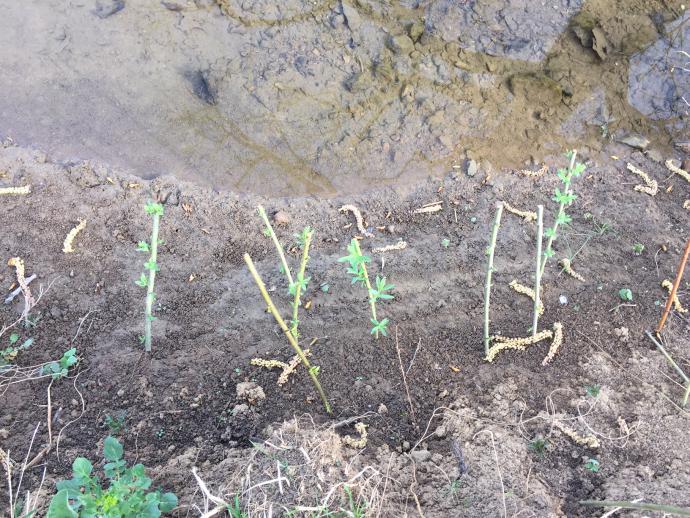
An example of a stream side planting completed in April 2017
Project Partners:
Project partners included the City of Harrisonburg, The Virginia Department of Forestry and The Green Infrastructure Center (GIC). Funding was provided by the USDA Forest Service and matched in-kind though participation by the city. City agencies involved on the Project’s Technical Review Committee include the Public Works, Planning, and Parks and Recreation staff. This group advises GIC and coordinates Harrisonburg community events.
Why was the Project Funded?
Rapid urbanization and climatic fluctuations have led to increased risk of flooding and degraded water quality in cities. Trees can be utilized as a key strategy for addressing this problem. Trees intercept, store, and transpire stormwater and are a vital tool in abating and cleaning stormwater runoff. One urban tree can intercept thousands of gallons of water annually. But while the benefits of trees are well known, most cities do not include trees as a component of their stormwater management strategies.
What Did Harrisonburg Get for Participating?
The primary outcome was a process for integrating trees into the city’s stormwater management program.
Harrisonburg received:
- Updated tree canopy and impervious land cover map used to map current canopy and analyze runoff, stormwater benefits and potential for mitigating stormwater.
- Potential planting areas map (digital GIS) used for strategic planning to set future canopy goals.
- Codes and Ordinance Audit for urban trees to facilitate better management and care.
- Analysis of stormwater benefits for both the current and potential canopy including analysis of currently available Chesapeake Bay TMDL requirements (MS4 Permit) and determination of how the PPA contributes to the city's Chesapeake Bay and local TMDL requirements
- Workshops with local committees to provide education and solicit input.
- Model ordinance language or other program/policy documents for using trees to meet stormwater regulations.
- Written step-by-step- strategy and methodology for linking urban forest systems to urban MS4 requirements for each of the specific partner city(s).
- Case study of the project suitable for sharing at workshops, with elected and appointed officials and other agencies and stakeholders.
Who is GIC?
The Green Infrastructure Center (GIC) is providing the technical support and project management. The GIC is a non-profit organization. More information about GIC is available at www.gicinc.org.
Public Meetings
Two public meetings were held while the project was being developed. The public meeting materials can be viewed below.
Public Meeting 1: March 25, 2017
Public Meeting 2: July 25, 2018
Public Meeting Presentation ![]() [10MB]
[10MB]
Poster 1: Land Cover Northeast Quadrant ![]() [2MB]
[2MB]
Poster 2: Land Cover Northwest Quadrant ![]() [3MB]
[3MB]
Poster 3: Land Cover Southeast Quadrant ![]() [2MB]
[2MB]
Poster 4: Land Cover Southwest Quadrant ![]() [1 MB]
[1 MB]
Poster 5: Possible Planting Areas Northeast Quadrant ![]() [1MB]
[1MB]
Poster 6: Possible Planting Areas Northwest Quadrant ![]() [2MB]
[2MB]
Poster 7: Possible Planting Areas Southeast Quadrant ![]() [2MB]
[2MB]
Poster 8: Possible Planting Areas Southwest Quadrant ![]() [3MB]
[3MB]


